Weather photography leaps forward
Our ability to track and predict storms, hurricanes, and other environmental developments is leaping into the future with a new NOAA weather satellite.
3.19.2018
Our ability to track and predict storms, hurricanes, and other environmental developments is leaping into the future.
Positioned 22,300 miles above Earth, a second Advanced Baseline Imager (ABI) for monitoring the Western Hemisphere will send Earth images, weather conditions, and environmental data back to ground control. Built for the National Oceanic and Atmospheric Administration's (NOAA) weather-monitoring mission and launched March 1, the Geostationary Operational Environmental Satellite-S (GOES-S/GOES-17) with its new ABI will transmit three times the amount of spectral coverage at four times the resolution and five times faster than older GOES satellites. This imager complements the GOES-East ABI launched in November 2016.
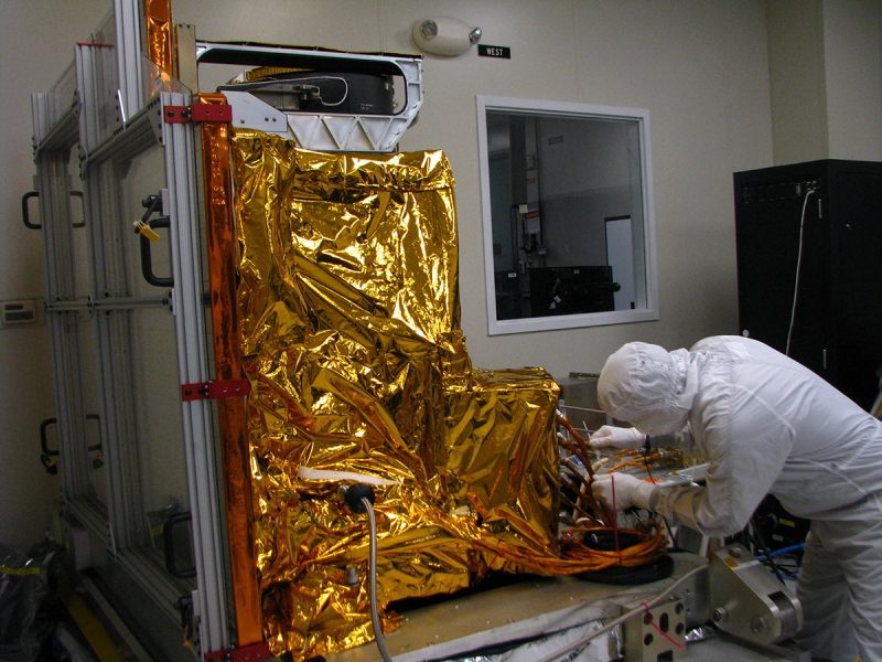
Non-flight model ABI prototype in a clean room in Fort Wayne
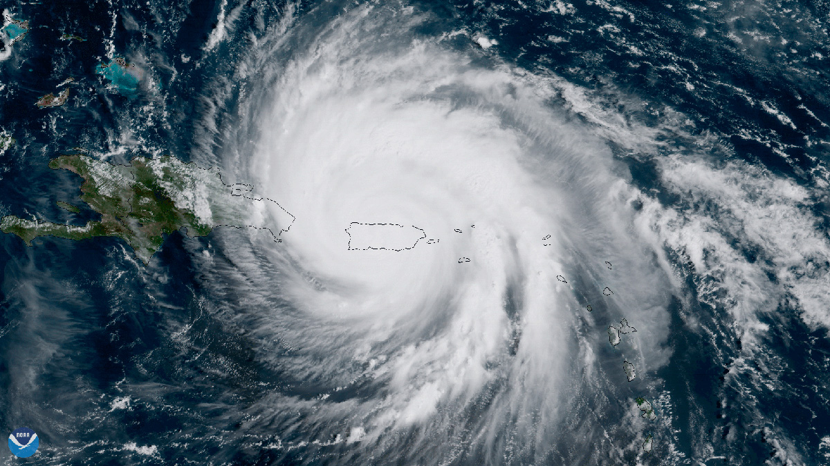
The imagery from this ABI is so clear and precise and refreshes so quickly—every 30 seconds—that it can be used to monitor and assist the response to rapidly changing events like thunderstorms, wildfires, and hurricanes.
High-resolution ABI images are comprised of 0.5 km pixels. At that resolution, images of the full Earth require 21,696 x 21,696 pixels (471 megapixels). The ABI captures pixels by scanning a horizontal path (called a swath) across the Earth. Then it moves down to a scan a new path until the entire planet is scanned. Full coverage of the Earth requires 22 swaths and takes five minutes. The older imager takes 25 minutes.
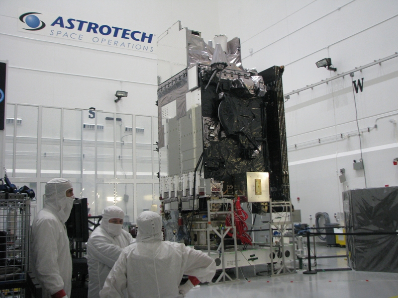
The full GOES-S satellite in the clean room
We asked Paul Griffith, chief scientist for the ABI at Harris Corp., makers of the imaging system, how the imager works.
“Unlike standard camera lenses, which are made from refractive materials such as glass,” he says, “ABI’s imaging device uses curved mirrors just like a telescope. It is a four-mirror re-imaging anastigmat telescope.
“The swath height is 0.9 degrees,” Griffith says. “This is rather narrow compared to a standard camera, but it is more than 60 times greater than the previous imager. From geostationary orbit, a swath covers over 500 kilometers at nadir. It takes only 22 swaths to cover the full Earth disk.” Nadir is the point on Earth directly below the satellite.
Imagery from the GOES-S satellite, which will be known as GOES-West when it’s stationed in orbit, is projected to be available in May. Its coverage area includes the United States and extends west as far as New Zealand. It will provide critical data for the westernmost United States, Alaska, and Hawaii.
Enjoy this gallery of images from GOES-East, which itself brought about huge advances in the NOAA’s ability to track and predict storms, hurricanes, and other environmental developments.
GOES-S video
GOES-R video
Atlas V GOES-S (GOES-17) Launch
 View Gallery